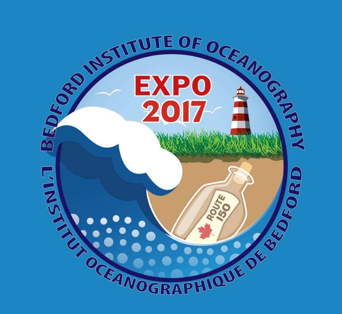
BIO EXPO 2017
Canada's premier centre for oceanographic research provides advice and support on ocean issues including safe navigation, offshore energy development, sustainable fishing, climate change, and protecting marine biodiversity and aquatic species at risk.
Comprised of more than 600 employees from six federal government departments, the Institute has become a welcomed part of its community by providing public tours and exhibitions; and by partnering with local universities, industry, and community groups.
The year 2017 marks the 55th anniversary of Canada's largest ocean research centre - the Bedford Institute of Oceanography. In celebration of this milestone, you are invited to learn about the Institute's various oceanographic research initiatives with an Ocean Science EXPO.
- What
- BIO EXPO 2017
- When
-
School Days - 21st-22nd Sept 2017 (Thu, Fri) 9 am
to 3 pm (for pre-booked school tours)
Public Days - 23rd-24th Sept 2017 (Sat & Sun) 9 am to 3 pm - Where
- The Bedford Institute of Oceanography (How to find BIO)
- Cost
- Admission is free
- Contact us
- Webmaster BIO / IOB Webmaster (DFO/MPO)
Teachers and Students
About the Institute
BIO EXPO 2017 - Exhibit Titles
Sharks of Atlantic Canada
With over 20 different species of sharks in Atlantic Canada, we are fortunate to have a rich diversity of these interesting and often, misunderstood animals in our waters. The Canadian Atlantic Shark Research laboratory at the Bedford Institute of Oceanography is responsible for research and stock assessment on the elasmobranch species found off the eastern coast of Canada. Ongoing research on the biology and abundance of these magnificent fish helps us insure that the population s remain healthy.
GSC 175 - The Early Years
GSC 175 - GSC in Nova Scotia
GSC 175 - GSC at BIO
GSC 175 - Women in the GSC
GSC 175 – Hudson
Coastal Drone Fly Throughs
Changing Climate, Changing Coasts
Oil and Gas in Canada
Where Cell Phones are Born: The Importance of Mining in a Gadget-Filled World
Our modern lives are full of gadgets, ranging from smart phones, personal computers, and gaming systems to hybrid cars, wind turbines and medical imaging equipment. Have you ever stopped to wonder what’s inside all of these devices, and where the materials come from? This exhibit will explore the wide range of chemical elements that underlie our modern standard of living, discuss the main sources of these elements, and take a close look at some of the social and environmental challenges that result from our dependence on electronic gadgets.
We’ll also discuss recent research by the Geological Survey of Canada that is helping to expand our country’s role as an environmentally responsible supplier of these important chemical elements.
We will focus on Critical Metals (e.g. rare earth elements, niobium, lithium, cobalt, etc.): the importance for green energy solutions for such things as electric cars, windmills, turbines and modern technologies
One issue we face as a society is the environmental challenge: legacy contamination vs. modern mining, our display discusses the role for Canada as a future leader in green mining
Finally, what are the social issues? Conflict minerals, ethical sourcing of raw materials (supply chain policies, etc.), NIMBYism, urban migration & infrastructure needs, importance of recycling & re-use (including landfill mining)
The Geological Survey of Canada at BIO (and other offices across Canada) is addressing these important issues on your behalf.Marine Cores - Stories Beneath the Seas
Marine cores are collected in Canada’s oceans to help us understand how sediments get to the ocean bottom. 10 m cores capture sediment that is < 40,000 years old!
Within this time, glaciers transported sediment to the seabed, especially large stones and sand. Earthquakes also occur along Canada’s coastlines. They cause sediment on the continental slopes to fail and fall to the sea-bottom as mass-transport deposits and turbid plumes of mud and sand. Clams, worms and other organisms with shells happily live in this sediment.
Marine cores capture all of these layers.
Lab instruments measure sediment properties so we can tell the story. Shells tell us the age of the sediment so that the story has a timeline. So... the next time you look at a sedimentary rock, remember that each layer, stone and shell provides clues to how it was formed!Rock and Fossil Road Show
Learn about the building blocks of geology with a fascinating display of rocks, minerals and fossils from Nova Scotia and around the world. Step back through geological time to see how Nova Scotia formed and changed over millions of years. Bring in your geological curiosities for one of our expert geologists to identify.
Periodic Table of Commercial Fisheries in DFO Maritimes Region. Tableau périodique des pêches et des flottilles dans la Région des Maritimes du MPO
A representation of the region’s commercial fisheries, by species group with number of issued licences, landed value, gear type, management system, and relative location in the water column.
Représentation des pêches commerciales de la région, par groupe d'espèces, avec le nombre de permis délivrés, la valeur au débarquement, le type d'engin, le système de gestion et l'emplacement relatif dans la colonne d'eau.Aquatic Invasive Species - Monitoring and Research
Underwater Imaging Technology at the Bedford Institute of Oceanography
St Andrews BIO-Blitz
Passamaquoddy Bay (Bay of Fundy) was one of the areas selected for a nationwide campaign of BioBlitzes organized by the Canadian Wildlife Federation to celebrate Canada’s 150th anniversary. Find out how scientists from the ARC and DFO explored this important marine area and what species they discovered. Marine debris is a growing environmental issue that affects Passamaquoddy Bay. Marine debris, particularly plastics, can damage all aspects of the marine environment. From cetaceans to crustaceans, see how ocean plastics affect different marine wildlife and their habitats. Explore this issue further and find out what you can do to help.
The Fishermen and Scientists Research Society: Championing Stakeholder Collaboration
Established in January 1994, the Fishermen and Scientists Research Society (FSRS) is a non-profit organization supporting an active partnership between fishermen and scientists. The FSRS was developed with two overarching objectives: 1) establishing and maintaining a network of fishermen and scientists capable of conducting collaborative research, and promoting effective communication between fishermen, scientists and the general public. Together, these allow us to collect and disseminate information relevant and necessary to the long-term sustainability of our fisheries.
The FSRS works on projects ranging from recruitment data collection to environmental and local knowledge research, the results of which have proven useful to government, fisheries-related nonprofits and academic institutions. It continues to this day to engage fishermen and scientists in projects related to the marine world and attempts to address a diversity of needs to ensure the future of our Maritime fisheries.Ocean Climate Change
In Canada and abroad, the impacts of climate change are becoming evident. Impacts such as coastal erosion; thawing permafrost; increases in heat waves, droughts and flooding; and risks to critical infrastructure and food security are already being felt in Canada. The science is clear that human activities are driving unprecedented changes in the Earth’s climate, which pose significant risks to human health, security, and economic growth. This exhibit will explore the issues related to ocean climate change including increasing ocean temperature and reductions in sea ice, ocean acidification and sea level rise.
Autonomous Robotics for Ocean Monitoring
One method of sampling the ocean is to use “robots”, equipped with scientific sensors, which can collect data even when a ship is not nearby. At BIO, we employ two different kinds of ocean robots: profiling (Argo) floats, and ocean gliders. At the robotics booth you will be able to see examples of our robots, as well as learn about the science and engineering that they employ for data collection.
Taking the Pulse of the Ocean: DFO's Monitoring Programs - Atlantic Zone Monitoring Program (AZMP)
DFO ocean monitoring programs are always watching! A visit to this exhibit will allow you to peer inside this ocean monitoring toolbox so you can see first-hand how we observe, track and report on changes in ocean chemistry, biology and physics. You will be able to ask us about life at sea on research ships, see the cool underwater robots we use, talk to us about observing the ocean from space and find out how climate change is impacting the ocean.
Ocean Engineering & Technology
The Ocean Engineering & Technology Section supports a range of science programs at the Bedford Institute of Oceanography through science equipment engineering and design, development and fabrication, and field preparation, deployment, and recovery. The section is unique relative to many other ocean science research centres, in that it houses a range of expertise on-site at the Institute that work with scientists directly to ensure research programs collect appropriate data in a safe and efficient manner and that research questions are adequately addresses. This exhibit will highlight some of the advancements and capabilities in ocean instrumentation and deployment techniques developed within this section.
Who Loves Lobster? Lobster Love, Lobster Babies, Love to Fish
Lobsters love lobsters, as shown in the little-seen lobster mating video, and we humans love lobster, which is why we are ensuring its sustainability through scientific research and fisheries management. We really love tiny baby lobsters: at less than the size of a quarter they can be seen in our touch tank! Come see where they choose to build their homes and how we find them. Learn about how they are fished and how important they are to the economy of the East Coast.
Satellite Remote Sensing of Wind, Waves, Oil Spills, Sea Ice and other Ocean Surface Phenomena
Satellite remote sensing can detect ocean surface features to resolutions of a few 10s of meters. A problem is always to differentiate the various phenomena that are observed. In this presentation, we provide a summary of the methodologies used, and the processes observed, for example: crude oil, macro-algae and mesoscale eddies, to list a few.NRCan - A New Social Media Approach
BIO Oceans Association - A Historical Look at BIO Marine Sciences
The BIO Oceans Association was organized to help preserve and display the history of BIO's scientific accomplishments, to maintain contact between BIO and its retired cadre of scientists, technicians and administrative support personnel, to serve as a vehicle for public outreach activities through its publications and occasional lectures, and to provide opportunities for continuing contact between BIO retirees.
Satellite Remote Sensing of Wind, Waves, Oil Spills, Sea Ice and other Ocean Surface Phenomena
Bay of Fundy - BIO Research Supports New Initiatives - Fundy Advanced Sensor Technology
The tidal flow through the Minas Passage boasts 14 billion tons of water, moving at speeds in excess of 5 m/s. Understanding this powerful environment is critical to successful turbine design, environmental effects monitoring, and ultimately unlocking Fundy’s enormous energy potential. FORCE created the FAST program to improve existing standards of site characterization, environmental monitoring and marine operations in high flow tidal sites.
Coastal and Ocean Information Network Atlantic - COINAtlantic
COINAtlantic is an Atlantic Canadian Network of organizations (government, universities, industry associations and non-governmental organizations) and individuals with interest in sharing data and information to support integrated coastal and ocean management as a tool to realize environmental, economic and social sustainability. The exhibit will show COINAtlantic products such as the Coastal Update E-newsletter, the coinatlantic.ca website and social media channels, and COINAtlantic data sharing web-based tools.
DFO - Remote Sensing
CMOS (Canadian Meteorological and Oceanographic Society) Halifax Congress in 2018
The Canadian Meteorological and Oceanographic Society (CMOS) is the national society of individuals and organisations dedicated to advancing atmospheric and oceanic sciences and related environmental disciplines in Canada. The Society’s aim is to promote meteorology and oceanography in Canada, and it is a major non-governmental organization serving the interests of meteorologists, climatologists, oceanographers, limnologists, hydrologists and cryospheric scientists in Canada. CMOS was officially created in 1967. The Society comprises over 700 members and subscribers, including students, corporations, institutions, and others who are involved in the educational functions, communications, the private sector and government. Membership is open to all who share an interest in atmospheric and oceanic sciences, their related sciences and applications. CMOS has several programs that support students, teachers and general public including the congress, publications, teacher’s day, and the tour speaker lecture series. To learn more about the society and its many outreach initiatives please drop by!
Grey Seals in the Northwest Atlantic
Fisheries and Oceans Canada has had a seal research program on Sable Island since the 1960s. There are two species of seal that are found on Sable Island, grey and harbor seals. Since the 1960s, the number of grey seal pups born on Sable has increased from just a couple hundred to just over 80,000. The Sable Island breeding colony is now the largest grey seal breeding colony in the world, producing 85% of the grey seal pups in the Northwest Atlantic. To understand the role of these predators in the marine ecosystem, research has focused estimating abundance and studying where seals forage and what they eat. On display are some of the satellite and archival tags used to help collect data on seal movement and behaviour, animations of individual seal tracks in the open ocean and videos free-ranging harbour seals and grey seals pursuing and capturing prey.
Atlantic Halibut on Scotian Shelf and Southern Grand Banks
Atlantic halibut is the largest flatfish in the world. In the northwest Atlantic halibut are found from Greenland to the Gulf of Maine. Atlantic halibut are commonly caught along the continental slope and deep channels, but are also caught closer to shore and on shallow banks, particularly in summer. The Scotian Shelf and Southern Grand Banks stock has recovered from a depleted state in the early 1990s and is now at its highest abundance since 1970. In 2013, this fishery was certified as sustainable by the Marine Stewardship Council.
The science program for Atlantic halibut is a collaboration between industry and Fisheries and Oceans Canada (DFO). Since 1998, the abundance of large halibut has been monitored by a longline survey completed by commercial fishermen with at-sea observers collecting data on the catch of halibut and other species. Since 2006, the Atlantic Halibut Council (AHC) has supported a tagging program to estimate natural and fishing mortality and to describe movement and behavior. The AHC has also supported a range of research programs including the aging of halibut using otoliths (bony ear structures), deployment of pop-up satellite tags to look at survival, movement and habitat use and special sampling for maturities and genetics analysis.
DFO’s research vessel trawl surveys on the Scotian Shelf provides an index of the abundance of small Atlantic halibut. This standardized survey has been used to identify potential habitat for juvenile halibut and areas of high abundance that have persisted since the 1970s in the face of large changes in the marine environment and the management of our fisheries.
On display are recovered pop-up satellite tags that collect and transmit archived information on the depth and temperature of halibut, otoliths and t-bar anchor tags used to track movements. Come and see how old a halibut as tall as you would be.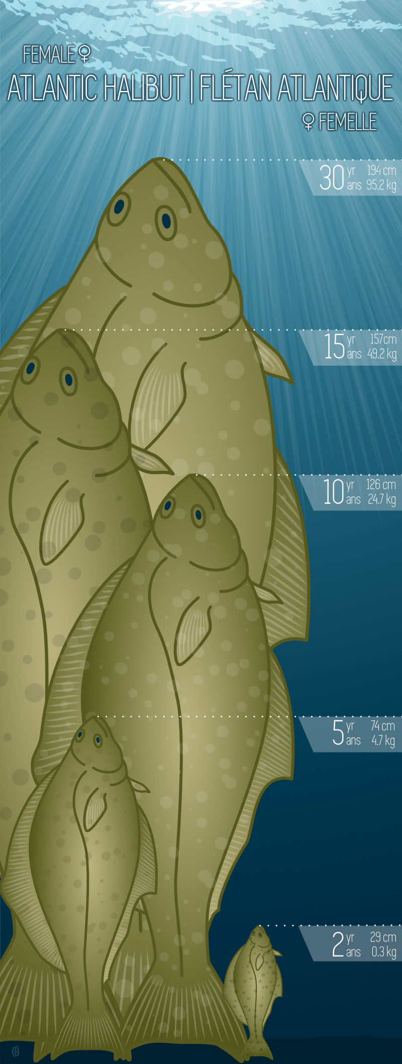
Lights, Camera, Scallops! Mapping the Seafloor for Sustainable Scallops
Where do scallops live? In partnership with the NSCC,DFO has combined multi-beam echosounder and seafloor imagery to describe and map scallop and associated benthic communities. In combination with spatial information on human activities, these seafloor maps can be used to sustainably manage scallop fisheries and contribute to marine conservation. Join us to see our 3D maps in-person, do a virtual ‘fly-through’ simulation, and play a quiz game to earn a prize.
Canadian Food Inspection Agency (CFIA) - Safeguarding with Science. l'Agence canadienne d'inspection des aliments (ACIA) - Préserver grâce à la science.
The Canadian Food Inspection Agency (CFIA) is Canada's largest science-based regulator. We work with federal, provincial and territorial science organizations, industry, universities and other partners to support and develop science that contributes to evidence-based decisions that better protect Canada's food, animal and plant resources.
Visit our booth to learn about shellfish toxins, safe food handling and invasive insects.Canadian Food Inspection Agency (CFIA) - Safeguarding with Science. l'Agence canadienne d'inspection des aliments (ACIA) - Préserver grâce à la science.
Ocean Modelling and Forecasting Using Supercomputers
DFO, Ocean Ecosystem Science Division has been over the last few decades observed a rapid progress in computer power and our capability in modelling and predicting changes in the ocean, including ocean currents, sea levels, temperature, salinity and sea-ice, etc. Here we present examples of ocean models developed in DFO and partner organizations for oceans around Canada, and the applications of the ocean predictions for fishery management, environmental protection, and safe navigation, etc.
Algal Research and Technologies at the NRC
Algae are all around us! Some are the colourful seaweeds you find on our beaches or wrapped around your sushi. Others are the microscopic cells that can turn your favourite pond or swimming pool green.
The National Research Council of Canada (NRC) has a long history of research on algae, reaching back to the 1940’s when NRC scientists in Halifax began to study seaweeds from our coastline as a domestic source of gelling agents to support the war effort. In more recent years, focus at the NRC’s labs in Halifax and the NRC Marine Research Station in Ketch Harbour, NS, has shifted to seaweeds as sources of food, fertilizers, cosmetic agents and natural health products.
The NRC’s research into microalgae has included the study of phytoplankton species that are nutritious food for shellfish, as well as the identification and monitoring of algal toxins from species that can form harmful algal blooms in our oceans and lakes. Other research programs at the NRC have developed technologies to put microalgae to work cleaning up greenhouse gasses and wastewaters, all while making valuable products including oxygen, biofuels, bioplastics, and even animal feed!
Join our scientists at the NRC’s booth at BIO EXPO 2017 to explore the diversity, beauty and many important uses of the algae that’s all around you! (It’s even in your ice cream!)Royal Canadian Navy / Maritime Survey Office
Come find out what the Navy is up to at BIO!
Ocean Gliders on the Scotian Shelf
The Ocean Tracking Network (OTN) and the Marine Environmental Observation Prediction and Response Network (MEOPAR), both housed at Dalhousie University, has jointly operated five Teledyne Webb Slocum gliders and one Liquid Robotics Wave Glider in Canadian waters since 2010. The gliders support of a variety of projects, including measuring water conditions to extend federal monitoring programs on the Scotian Shelf, characterizing whale habitat on the east and west coasts of Canada, detecting acoustically-tagged animals, and offloading data from bottom-mounted acoustic receivers. In this presentation you will find out about our efforts to use the Wave Glider to detect snow crabs tagged off Cape Breton as part of an environmental assessment of the Maritime Link power line. We will also present information about our efforts to monitor whale locations in the Gulf of St. Lawrence and the Scotian Shelf using profiling Slocum gliders equipped with passive acoustic hydrophones.
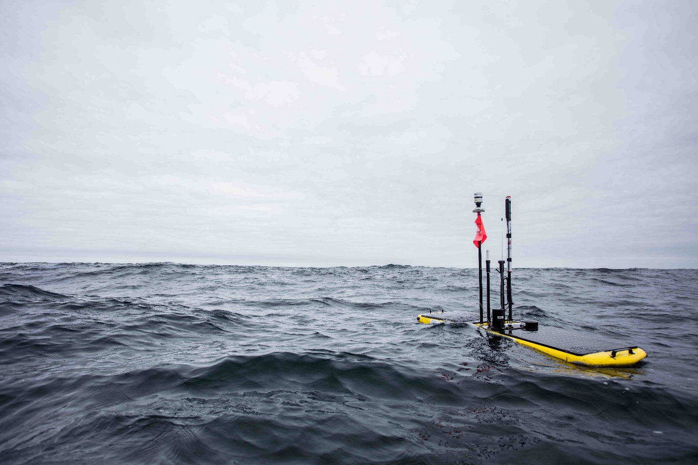
Wave Glider cruising along after deployment on Scotian Shelf.
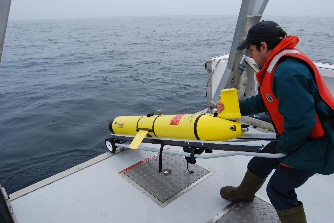
Slocum glider being launched off the back of BIO vessel SigmaT
Where do snow crabs go? Ocean Tracking Network, DFO, and Community-driven Research in Cape Breton
The snow crab (Chionoecetes opilio) is the third most important fishery species in terms of landing value in Nova Scotia. Based on fishery landings, snow crabs are thought to segregate by sex and size. The species is migratory, based on the seasonal disappearance and reappearance of crabs in different geographical areas, and limited tagging studies that have been conducted to date. However, the tagging studies necessary to document the scale and scope of such migrations have not yet been conducted. Information about the migratory movements of the species will be very important to managers as they determine quotas for fisheries in the different crab fishing zones (geographical management areas). At present, snow crab movements are too poorly understood to assist in developing management regimes for the species. This project was initiated by crab harvesters desiring to generate accurate information on the migration of crabs among different crab fishing areas in Nova Scotia, so that equitable quotas could be assigned to fishermen in the different regions. Partners in the project include the Ocean Tracking Network, and the Department of Fisheries and Oceans.
Environment and Climate Change Canada (ECCC), Water Quality Monitoring in Shellfish Harvesting Areas
Environment and Climate Change Canada (ECCC), Water Science and Technology Division, Marine Water Quality Monitoring
Environment and Climate Change Canada (ECCC) is one of three federal government departments who deliver the Canadian Shellfish Sanitation Program (CSSP). The purpose of the CSSP is to protect public health by ensuring shellfish harvested in Canada are safe to eat. ECCC is responsible for monitoring marine water quality and performing sanitary shoreline surveys to identify pollution sources in shellfish growing areas. Enjoy safe shellfish- Check before you harvest!BIO EXPO 2017 local school art work contest - design of a "ROUTE 150" logo
To help kick-off the Bedford Institute of Oceanography (BIO) EXPO 2017 local school children submitted art work that helped inspire our design of a "ROUTE 150" logo.
The submitted art work on display celebrates 2017 which marks Canada 150, the 150th anniversary of our great country! It also marks Geological Survey of Canada 175, the 175th anniversary of the Geological Survey of Canada, Fisheries and Oceans Canada 150, the 150th anniversary of Fisheries and Oceans Canada, and Bedford Institute of Oceanography 55, the 55th anniversary of Canada's largest ocean research centre.Indicators for Ecosystem Management
Marine ecosystems are changing! How are they changing? Why are they changing? How will this impact me? Oceans are complex systems affected by both human and environmental pressures, and need to be managed with this understanding. To answer the questions above, we need to take an ecosystem approach that considers organisms and their environment together. However, we cannot examine all life in our oceans for a check-up to assess the health of the ecosystem. Solution? Use indicators of ocean health to monitor ecosystem changes. With our own health, one indicator alone, like temperature or blood pressure, will not tell the full story. You need many indicators of human health together to assess how well the body is working. In the ocean, we use a suite of indicators to track ecosystem change over time and monitor ocean health. So what’s the health of our local marine ecosystem, the Scotian Shelf? It depends on who you ask! For a lobster things have gotten better! Lobster biomass has increased in the Scotian Shelf, and revenue to fishermen is approaching a billion dollars. For cod, things have not improved much since their collapse in the East. For the ecosystem? There have been systematic long term changes such as a decrease in the average size of fish, a decrease in fish health, and changes in invertebrate abundance. In our exhibit we present three indicators for the Scotian Shelf, but many more are available: https://incorporatingecosystemapproach.shinyapps.io/indiapp/
Paparazzi of the Deep: Capturing an Exclusive First Look at Marine Invertebrates on the Seafloor
The deep sea covers the majority of the Earth’s surface, yet it is the least-explored habitat on the planet. The focus of our research in the Benthic Ecology Lab at the Bedford Institute of Oceanography (BIO) is on benthic marine invertebrates: animals without backbones that live on and in the seafloor of the deep sea (> 200 m). Marine invertebrates are known to play pivotal roles in ocean ecosystems, often by providing food and shelter for other organisms. Our group is particularly interested in the biology, ecology, and spatial distribution of structure-forming invertebrates such as sponges and corals, because they create habitat for other animals, including commercially-important species. Knowing where such organisms live allows us to better protect them. Our exhibit will showcase marine invertebrate specimens collected from multiple study areas off Canada’s coast, including the Emerald Basin on the Scotian Shelf and the Flemish Cap off the coast of Newfoundland. We will also highlight the research methods and sampling equipment used to gather data, and will display sampling equipment if possible. There will be a hands-on activity involving how we collect samples, and video footage of coral and sponge habitat collected by a Remotely Operated Vehicle (ROV) will be shown. Visitors will leave with a broader understanding of life on the seafloor, and how and why we study and protect it.
Expanding Canada's Borders - United Nations Law of the Sea (UNCLOS)
Maritimes Region Aquatic Species at Risk. Région des maritimes Espèces aquatiques en peril
This exhibit will profile regional marine and freshwater/diadromous species that are listed as endangered, threatened, or special concern under the federal Species at Risk Act (SARA). Listed species include whales, turtles, sharks, fish, and mussels. Come learn more about these amazing animals and what you can do to help conserve them.
Keep our Lakes, Rivers and Streams Clean for Freshwater Species at Risk
Many of us enjoy a cottage on a lake, fishing in a stream, or canoeing on a river, but how much do we really know about the animals who call these places home? Come learn about the fascinating freshwater species who live in our lakes, rivers, and streams and those who are now listed as Species at Risk. There are things we can all do to help keep their habitats clean and healthy and to help them recover; it all begins with learning who’s who and understanding their needs.
Fish Habitat – Ours to Protect
Get your hands wet learning what you can do to protect fish and fish habitat. See how many of our ‘good practices’ are already part of your good ‘habits’ and what else you can do to protect our fishy friends. Our geo-model mimics a river environment and will allow you to see the impacts that developments such as culverts and bridges can have on fish and their homes.
Our diorama displays show different types of activities that can disrupt or destroy fish habitat and some of the ways we can protect and conserve it. Compare the two models and see if you can spot the habitat friendly practices.
You can also meet HARV senior and his son HARV junior. HARV ‘flies’ through the water using his remotely operated underwater camera to show us our fish friends and their secret homes beneath the waves. Come and see a demonstration of HARV senior in Bedford Basin or take HARV junior for a spin around our aquarium.Sounds of the Sea: Listening in on Cetaceans
Do you speak whale? Cetaceans (whales, dolphins, and porpoises) use sound to communicate, navigate, forage, and avoid predation. There are a variety of calls made by different cetacean species, and here at BIO, our scientists are listening! Through passive acoustic monitoring of underwater sounds we are able to increase our understanding of when and how cetaceans are using our waters. We are also able to monitor noise and identify areas where cetaceans may be at risk from human activities. Come visit us at the 2017 BIO Open House at the Sounds of the Sea booth to learn about different whale calls and how we use those calls for research. You can also try to imitate some of those calls - you never know, you may be able to speak whale after all.
Marine Protected Areas in Canada: Protecting a Tenth of our Ocean Territory by 2020
This exhibit will introduce visitors to Marine Protected Areas (MPA) as one of the country’s fastest evolving tools for protecting marine biological diversity; in essence, the multitude of sea creatures and habitats studied at BIO and on display throughout the Expo. High level themes will illustrate the benefits of MPAs and emphasize the Government of Canada commitment to placing 10% of the country’s marine territory under stringent forms of protection by 2020. A key message for visitors is how plentiful work is underway at BIO to identify where and how those targets will be met. Local sites including the Gully, Musquash Estuary, coral gardens and sponge acres will be profiled using photos, maps and brief text descriptions to communicate ecological highlights and activity restrictions, with the ultimate aim of conveying what MPAs look like in practice rather than policy. Interactive displays include a 3-D solid model of the Gully submarine canyon, a head-shot photo booth and a hands-on game designed to challenge contestant’s knowledge of MPAs and the special places they protect in Canada.
Ocean monitoring in the Canadian High Arctic
Canadian Coast Guard – Search and Rescue
Canadian Coast Guard
Canadian Coast Guard - Environmental Response
Canadian Coast Guard - Aids to Navigation
Canadian Coast Guard - Marine Communications and Traffic Services
Canadian Coast Guard College
75 Years of Ocean Science for Canada's Navy
Defence R&D Canada has had a long history of Ocean Science research since its creation during World War II – DRDC recently celebrated its 75th anniversary. The branch of DRDC located in Dartmouth conducts ocean-related research supporting the Royal Canadian Navy and is the founding branch of an organization with laboratories all across Canada that provides scientific advice to the entire Canadian Armed Forces.
Highlights of DRDC’s oceanographic research have included development of the bathythermograph in its earliest days, to more recently, partnership with NRCan in using an Arctic Explorer autonomous underwater vehicle to map the extent of the Arctic continental shelf. While DRDC has had a low public profile, world-leading research is being done here in areas such as ocean acoustics, ship hydrodynamics, materials science, maritime information systems and more.Atlantic Salmon – Eastern Cape Breton and Southern Upland Populations Stock Assessment & Scientific Advice
Atlantic Salmon is an iconic species of Aboriginal, social, cultural, economic, and recreational significance in Canada. The Committee on the Status of Endangered Wildlife in Canada (COSEWIC) identified four large groups of Atlantic Salmon, referred to as Designatable Units, in DFO’s Maritimes Region: 1) Eastern Cape Breton; 2) Nova Scotia Southern Upland; 3) Outer Bay of Fundy; and 4) Inner Bay of Fundy. The abundance of Atlantic Salmon in DFO’s Maritimes Region has been in decline for more than two decades, populations in many rivers are now extirpated (i.e., salmon no longer exist in those rivers), and Inner Bay of Fundy Salmon are listed as Endangered under the federal Species at Risk Act. In 2010, COSEWIC assessed the Eastern Cape Breton, Southern Upland, and Outer Bay of Fundy population groupings as Endangered (i.e., considered to be at risk of going extinct / no longer existing in these areas). These population groupings are currently being considered for listing under the Species at Risk Act.
The core focus of our work is to assess and monitor the status of Atlantic Salmon populations in Eastern Cape Breton and the Southern Upland by estimating the number of Salmon at different life stages using a variety of techniques. The information is then used to provide scientific advice for potential management decisions. Atlantic Salmon have a complex life cycle where they begin life as eggs buried in gravel in rivers by spawning adults. The eggs then hatch and the small Salmon develop through fry and parr life stages before becoming smolts. Smolts leave their freshwater environment and migrate to the ocean, where they eat and grow for one or more years until they are mature adults. Mature adults then return to the river where they were born to spawn and lay eggs. DFO Science uses a variety of methods to assess the status of Salmon at a number of index rivers within the Region. For example, we use: electrofishing surveys to evaluate fry and parr populations; smolt wheels and fish passage facilities to assess smolt populations; and snorkel surveys, counting fences and fish ladders to assess adult populations.Canadian Hydrographic Service – Hydrography in Action
Canadian Hydrographic Service – Operational Tidal Gauge
Canadian Hydrographic Service – Survey Launch Dive In - Earn an Advanced Diploma in Oceans Technology and Prepare for a Career in the Growing Oceans Sector
At NSCC we work to develop practical and innovative solutions for real-world, ocean related challenges. Our research teams consist of faculty, staff, and students from some of the most challenging and cutting-edge programs in Atlantic Canada. These teams work closely with government partners on research projects and with industry to help improve products and grow their businesses. NSCC has the well-equipped facilities to provide our people with the tools to contribute to the development of new technologies that we in turn, transfer to our partners. Our projects and partnerships add value to the communities we serve and contribute to the economic growth of our province.
Sustainability at the Bedford Institute of Oceanography COOGER: Oil Spills and Applied Research
COOGER: The Tiniest Oil Spill Responders - Attack of the Microbes
COOGER: Investigating Oil Spill Countermeasures
An oil spill in the ocean can have very negative impacts on marine ecosystems. Oil spill responders rely on a variety of techniques to help reduce these impacts on the marine environment such as booming, skimming and in-situ burning. In addition to these efforts, processes such as biodegradation or bioremediation can assist with the natural recovery of the ocean thanks to bacteria that live in the water. By using a soap-like chemical known as a dispersant (surfactant), an oil slick can be broken up so that it covers less area on the surface, and bacteria in the ocean can consume the small droplets of oil dispersed in the water.
The Centre for Offshore Oil, Gas and Energy Research, COOGER, contributes to DFO’s mandate to protect fish habitat and the fisheries by evaluating oil spill countermeasures. COOGER has conducted numerous field experiments in Canada and abroad involving the controlled release of oil to evaluate the efficacy of various oil spill countermeasures.
Stop by our exhibit to see how an oil spill behaves in the ocean with and without bioremediation, have some fun creating your own microbe, then visit our Wave Tank facility where your critters can race through the water!COOGER: Centre for Offshore Oil, Gas and Energy Research - Wave Tank
Canadian Coast Guard - Pollution Response Vehicle & Fast Rescue Craft
Canadian Coast Guard - The Ship Canadian Coast Guard – Helicopter
Route 150
Live Aquatic Species
BIO EXPO Cafeteria Tent
- Date modified: